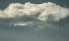
Altocumulus cloud
© Kr-val
Altocumulus is a mid-level cloud that usually forms between 6,500 to 22,000 feet. These clouds look partly white and partly greyish, in the form of heaps, rolls or billows. They consist of super-cooled water droplets and often present ice crystals. Usually, this type of cloud doesn’t produce rain but can indicate a change of weather within the day.
What does it forecast?
On a warm and humid summer morning, altocumulus indicate possible thunderstorms in the late afternoon, or just deterioration in the weather. Some types of altocumulus announce no change in future weather.

HIGH CLOUDS: Cirrocumulus

HIGH CLOUDS: Cirrostratus

MIDDLE CLOUDS: Altocumulus

MIDDLE CLOUDS: Altostratus

MIDDLE CLOUDS: Nimbostratus